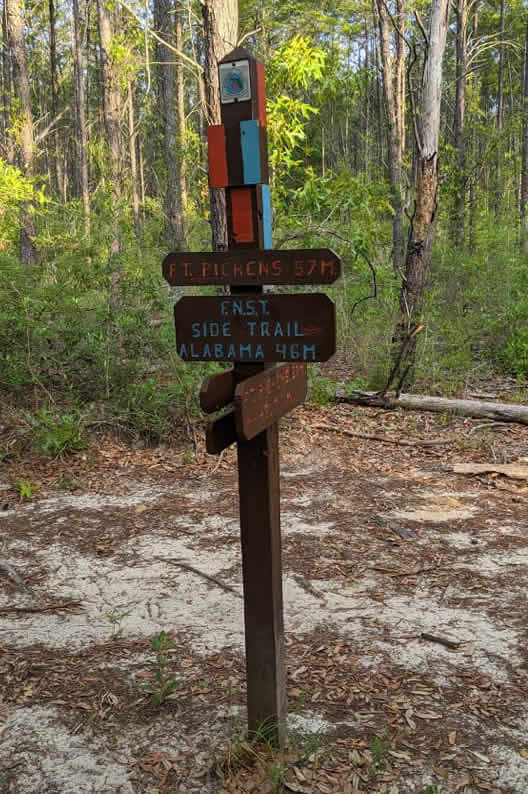
The 100 Mile Battle to Fort Pickens is a 100+ mile endurance run (closer to 103 total miles) that starts at the Florida/Alabama line north of Hurricane Lake, follows the Florida National Scenic Trail (FNST) Side Trail through Blackwater River State Forest, connects to the FNST at the Harold Store and continues south to the Gulf of Mexico, ending at Fort Pickens in the Gulf Islands National Seashore. It will be hot, it will be challenging, it will be a true battle to go the distance in the middle of July in the Florida heat.
This race isn’t an official race, but more of a running adventure with bad influencers who make questionable decisions to run distances that are stupid and routes that normal people wouldn’t do unless something was chasing them. The challenge is free and I only ordered 10 custom buckles for those who complete the beautiful, yet challenging adventure. The information on this website will be updated as we get closer to the start.
Below are some links and information on specific locations along the route.
The route goes right by here around mile 67-70 so this would be a good place to use your vehicle as a drop bag location. It’s about a 01h:05m drive to the start from here. In addition, it would also make the shuttle back not too far either.
To drive there, you have to go past the church and take a right on Rock Creek Road. Stay on Rock Creek Road and take a right on County Road 346 all the way until the end where the trailhead is. The road was wet and a little muddy when I got dropped off there but no 4 wheel drive was needed. I’ve taken my car there in the past but I wouldn’t recommend taking a vehicle that’s lower to the ground right now. I’ll check the condition of it and if needed to, we can just get dropped off Beaver Creek Rd. at the FL/AL border and walk the side road to it (it’s blocked off from driving). There is a trail log book inside the mailbox. I recommend signing your name, date/time and info if you want.
Bathrooms and water are at the building if needed.
Parking lot is on right side after crossing bridge.
Trail exits onto Peaden Bridge Road and follows the blazes down the road and over Peaden Bridge for almost a half mile. Watch for the blazes that turn to the left to get back on the trail. This is across from the house with the red fence and a lot of animals. There’s a monkey there in a cage near where you get back on the trail.
Trail exits onto McVay Road and follows the blazes to the left and down to Hwy 4, then take a right and cross over the bridge and immediately take a left onto Country Line Road. Look for the blazes that turn to the trail on the right (about 100′ after you turned off Hwy 4). Get back on the trail.
Trail crosses over Red Rock Road
Trail goes by building with bathrooms/water, crosses over Deaton Bridge, goes down Deaton Bridge Rd. for a little bit, then the trail is on the right.
Closes at 7pm.
Trail exits to Nichols Creek Road here and the route will be on the road for a while. Keep going straight until it ends and take a left to stay on Nichols Creek Road. Keep going until it ends and take a right on Nichols Lake Road. Keep going about 2.7 miles until the red light at Hwy 87 where the Tom Thumb is.
CREWS: The manager at the Tom Thumb might try to run you off if you’re just parked there waiting.
The manager there might try to run you off if you’re just parked there waiting. Apparently they have problems with people making drug deals there. I would be careful when pulling out any pills or white powder (tailwind) here as someone (manager, police, drug dealer, crackhead, meth-head, etc.) might really think you’re running dirty here! 🙂
From Tom Thumb, we head south towards Navarre. Cross back over Hwy 87 and stay on the left side of Hwy 87 (north bound lane). Yellow River bridge has the pedestrian crossing on this side. It is also safer to see the traffic coming towards you, so get off the road if the cars aren’t in the passing lane. Some parts of the road have plenty of space where you’re far enough from traffic too. Just be safe and smart.
This is where the route will crossover to enter the Eglin Trails West of Hwy 87. If you don’t have the “thru-hiker” permit and its night time, then I would just skip this section and stay south on Hwy 87 towards Navarre.
This is where the main parking lot is where we get shuttled to the start. This is a good drop bag spot.
Good spot to start the long beach stretch. Head west towards Pensacola Beach on pedestrian pathway until it ends at the beginning of the Gulf Islands National Seashore. Crossover and go towards traffic in the bike lane. Move off road if cars/peddlers don’t give you space. Just keep heading towards Pensacola Beach.
Bathrooms and water if needed.
Bathrooms and water if needed. From here, the route has you go down the beach for about 4.5 miles until
This is where we crossover from the beach to the Fort Pickens trails. Bathrooms/showers/water available at the building at the beach. From the beach, go through the parking lot to the main road, then cross the main road (Fort Pickens Rd) and go behind Battery Langdon where the trail picks back up. Stay straight on the trail to Fort Pickens.
The trail ends right at the main parking lot for Fort Pickens. The trail log book is inside the visitor store behind the counter and we have to ask the person working about signing it. I signed by date/time, name and short description of the run. You don’t have to but I recommend it. I believe the store closes at 4 pm.
There are various places to park. Once we find out who all is running the 100 miler and who is pacing/supporting, we can establish the best parking locations.
The initial plan for those running from the start is to park midway at one of the parking lots and be shuttled to the the start. At the finish, those who parked midway will get a ride back.
The majority of the water stops will be between 5-10 miles. There will also be additional locations to get water on the route (stores, parks, etc.), as well as bathrooms at parks and stores.
The initial plan is to setup a few drop bags in a few locations, whether stashed, in a parked vehicle or with a crew. Once we get closer to race day and get a head count of everyone, we can establish the actual spots.
Some basic snacks, water and even your own nutrition (if provided before race day) will be at all water stops. There are also stores along the way (even a Waffle House). Late night food will be planned once we get closer to race day.
There are about 12 miles of trails that run through the Eglin Air Force Base reservation, which requires you to register and purchase an outdoor recreation permit to be on their property (get permit here).
After the first two battles, there are only 5 custom made belt buckles left for those who complete the full 100+ mile endurance adventure. The adventure is challenging and will not be easy, especially being held in the summer heat in Florida. However, there is strength in numbers and we can battle through it together and conquer.
I’m hoping running friends will join us for different sections of the run or help us with various parts of the adventure (aid station, shuttle to start/cars, nutrition, etc.). The running community in NW Florida is amazing, so please contact me if you can help out or contribute in any way for any portion of the adventure.
This run is not a certified event, but more of a group adventure with crazy running friends who like to do crazy challenges. The initial plan (and most likely to happen) is to run as a group the entire way, but this may change if there were enough people to split into different groups.
Please contact me if you are thinking about joining for the full 100+ (or any portion of it), or if you are willing to help us in any way.
Thanks,
Greg Schnoor
To help organize and plan things, below is a list of the crazy awesome people who have committed to this – much appreciated! Please contact me and let me know if anything needs to be added/removed/changed.
Greg
Matt
Mindy
Rebecca
Kenny
Geoff
Rex
Robert
Stephen
Lori
MJ
Massoud
Crystal
Jon R.
Jon S.
.
Cindy
Mark
Phillip
Massoud
Crystal
Jon S.